
Reading Previous Residents Sources
To identify previous residents of one Reading address, start by separating the ownership trail from the household trail. A deed records a transfer between parties. A directory, census schedule, or newspaper can place a person or family at an address on a particular date. The records overlap, but none is a complete annual list. This era map shows the strongest locally documented routes and the limits that belong with each one.
| Source | Years It Covers | Where Held | What It Shows |
|---|---|---|---|
| Middlesex South Grantor Indices | 1896-1973, officially announced online | Registry notice and MassLandRecords | Grantor index route; earlier and general index coverage must be verified |
| Massachusetts Land Records | 1620-1986 collection range | FamilySearch browse-image collection | Historical deed books and images; image rights can vary |
| Reading directories | 1869, 1874, 1884, 1886-87, 1888-89, 1892-93, 1896-97, 1898-99, 1900-01, 1902-03, 1905, 1907, 1909, 1911-12, 1913-14, 1915-16, 1917-18, 1919-20, 1921-22, 1925, 1931-32, 1934, 1936, 1938, 1941 | Massachusetts State Library; 1869 item at Historic New England | Names, addresses, and business presence in surviving volumes |
| Reading Chronicle | 1881-1980 authority record | Reading digital archive and Library of Congress record | Notices, obituaries, events, and address clues |
| Federal census | Public through 1950 | National Archives and library genealogy services | Decennial household snapshot, not annual address proof |
| Assessment and Street Listing | FY2026; listing dated January 6, 2025 | Patriot Properties and the Town of Reading | Assessed owner, location, value, and parcel fields as of January 1, 2025 |
For a twentieth-century address, begin with the parcel and Registry trail, then use the nearest directory or census date to test a household connection. For an earlier property, the FamilySearch land collection and Reading assessors' tax lists, which cover 1663-1705 and 1750-1803 on film 968004/DGS 7940926, offer additional leads. They are not substitutes for the missing years between them.
Reading's Current Parcel Record
Begin the previous residents search with the property, not a bare street number. The Reading Assessment search accepts Street Name, Owner Name, or Parcel ID and identifies the current FY2026 assessment context. The official 2025 Street Listing is dated January 6, 2025, and the assessment information describes ownership and assessment changes as of January 1, 2025. Record the situs location, assessed-owner field, parcel ID, and any map or lot reference exactly as displayed.
An assessed owner is not proof of every person who lived at the property. Likewise, an owner mailing address can differ from the Reading situs address. Keep those fields separate, and use the parcel ID as the connection to the map, deed index, and older tax material. The parcel is the stable starting point when an old directory shortens a street name or an address later changes form.
Previous Residents and Grantor Indices
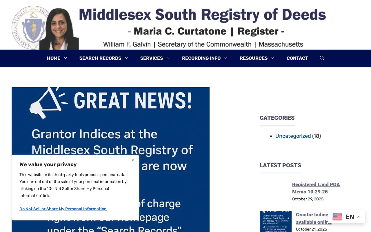
On October 21, 2025, Middlesex South announced free online access to Grantor Indices for 1896-1973. That improvement makes it easier to move backward through a Reading deed trail, but it does not establish a general online cutoff for every recorded-land index. The Registry's Grantor Indices announcement is the clearest source for the published range.
The Registry notice documents the online historical-index release pictured below.
Search results need narrowing. The Registry says broad MassLandRecords searches can stop at the first 1,000 rows, so combine a party name with Reading, a document type, and a date range when possible. Check Recorded Land, Registered Land, and Plans when a deed or reference points to another department. A related plan or registered-land certificate may not appear in a single default search.
Reading Deed Chain Steps
The Middlesex South Registry is the recorded-land custodian for Reading. MassLandRecords offers Property, Name, Document, Book, and Recorded Date searches. Online searching, viewing, printing, and downloading were free when inspected. A certified copy is different: the published fee is $1 per page, while a registered-land certificate is $5. The Registry is at 208 Cambridge Street in Cambridge, with public research hours Monday through Friday from 8 a.m. to 4 p.m.; recording ends at 3:45 p.m.
- Copy the current parcel's Reading situs, assessed owner, parcel ID, and legal description from the assessment and the most recent deed you can locate.
- Search the current owner in MassLandRecords and identify the purchase instrument by document number or book and page, recording date, and party roles.
- Read the deed's legal description, plan reference, and grantor. These details help distinguish same-name parties and addresses that changed over time.
- Search that seller as a grantee to find how the seller acquired the property. Record the prior instrument and repeat the same comparison.
- When the published online path ends, confirm the earlier route with the Registry or use the FamilySearch Massachusetts Land Records collection, which is browsable and may have access limits.
- Grantor
- The party transferring an interest in a deed or other Registry instrument.
- Grantee
- The party receiving that interest. Searching a later seller as an earlier grantee is the key backward step.
- Chain of title
- The sequence of recorded transfers that links one owner or interest holder to an earlier one.
- Legal description
- The parcel description in the instrument, often tied to a plan, lot, bounds, or adjoining land. It can survive when a street number does not.
- Enumeration district
- The census area's geographic unit. It helps locate the correct census pages once a household and address are narrowed.
Reading Previous Residents by Year
Deeds show transfers, not every household. To ask who lived here before, line up the deed dates with the nearest surviving Reading directory and federal census. The State Library holds the specific Reading directory years listed in the era table, but no continuous local criss-cross or Polk sequence was verified. A directory can be surname-organized and may include an address or house guide. Inspect the actual volume before assuming it supports an address-first search.
- Choose the directory year nearest the ownership interval and search the surname, initials, spouse notation, and any street abbreviation.
- If that volume includes a house guide or reverse section, test the street and number. If it does not, preserve the name-first result rather than inferring an address match.
- Open the nearest public census, currently through 1950, and compare household members, town designation, street name, and the enumeration district.
- Check the Reading digital archive for a notice, obituary, business reference, or local event that supplies a date or address clue. Read the scan, not OCR alone.
- Return to the deed chain to see whether the household period fits an ownership transfer, mortgage, estate matter, or later sale.
The 1869 combined Stoneham, Wakefield and Reading directory and the later State Library years are covered in greater detail in the Reading directory collections. A missing directory entry does not prove an address was empty. It may reflect a collection gap, a different spelling, an unlisted household member, or a town-section issue.
Reading's FY2010 Parcel Bridge
Reading renumbered all tax maps and lots in FY2010 to support new financial software and simplify map and lot numbering. That is a local continuity trap. An old deed, tax list, or assessment reference may still describe the same land while no longer matching the current parcel ID character for character. No official source located a townwide street-number renumbering project with a date, so do not assume a street number changed or remained fixed.
Preserve the old map and lot reference. Then compare the tax map, legal description, plan, parcel shape, and adjoining owners to carry the historical parcel into the present system. The Town's property lookup tools and its map resources can help with the current side of that comparison; the Registry instrument provides the historic wording.
Reading Home-History Evidence
Reading Public Library's local-history service provides an address-focused route when registry and directory evidence leaves a gap. Its Local History Room is available by request, private genealogy appointments are available with the Local History Librarian, and the “Research Your Home” guide can frame a focused question. Provide the address, approximate construction or ownership period, and whether the goal is a deed chain, occupant history, architecture, or newspaper evidence.
The library adds historic maps, annual reports, yearbooks, obituaries, newspapers, and local publications. Annual reports displayed in the digital archive cover 1871-2007, while the library describes Reading High School yearbooks from 1892-2021. The Historical Commission inventory, with about 350 properties dated 1694-1953, can connect a street address to a property name, style, inventory number, and historic context. These are house-history leads, not a complete list of past residents.
Lawful personal use. Use previous-resident research for family history, house history, heir research, or personal curiosity. Do not use names, address history, or record images to harass, stalk, or harm anyone; Massachusetts provides legal protections for protected addresses and other sensitive records.
Reading Sanborn and Probate Leads
Sanborn fire-insurance maps can help date a building footprint, use, materials, and the correct sheet for a block. The official Library of Congress Sanborn guidance describes searching by city, state, edition, and sheet. An exact Reading edition-year list was not located in the inspected official sources. Search the Library of Congress by Massachusetts and Reading, then ask the Local History Room whether another map collection holds the needed sheets. Do not fill that gap with an invented local map run.
Newspaper notices and probate can close an address trail. The Library of Congress dates the Reading Chronicle authority record to 1881-1980, while the local archive can surface a notice or obituary. For estates, Reading falls within Middlesex Probate and Family Court North in Lowell. A probate docket may identify an estate, executor, heirs, or a property transfer, but file access can be restricted or impounded. Use a notice, probate filing, and recorded instrument as mutually checking evidence rather than treating any one as a complete account of past residents.